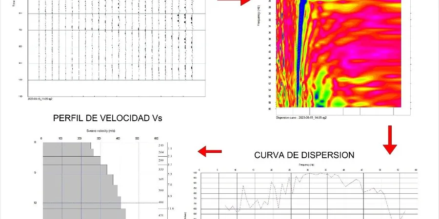
Burlington sits at roughly 74 meters above Lake Ontario, but the real story is underground. The city's position between the Niagara Escarpment and the lake basin creates a subsurface profile that varies dramatically within a single city block. Glacial till, dense silts, and the Queenston Shale bedrock all interact with seismic waves differently. A 2015 seismic hazard assessment by Natural Resources Canada placed Burlington within a moderate seismicity zone, which means site-specific ground motion analysis isn't just academic—it directly impacts structural design loads under NBCC 2020. The MASW method cuts through this complexity. Surface wave propagation analysis delivers a continuous VS30 profile without drilling, which proves invaluable when you're dealing with the unpredictable depth to bedrock found near the Escarpment's toe. We combine this with seismic refraction when the bedrock surface needs precise mapping for foundation decisions.
A VS30 value is not just a number for the geotechnical report—it's the single parameter that can shift your seismic design category by a full class.