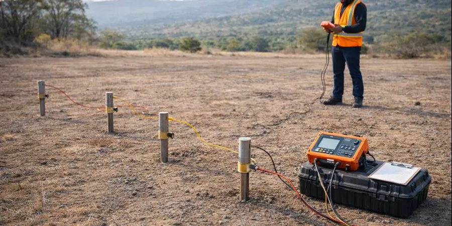
The Niagara Escarpment cuts right through Burlington, creating a geological puzzle that shifts from shallow limestone bedrock in the north to deep glacial till and shale in the south, near Lake Ontario. When you add the creeks—Grindstone, Shoreacres, Tuck—and the moisture they carry into the overburden, guessing at subsurface conditions without data becomes a costly gamble. Electrical resistivity testing, specifically Vertical Electrical Sounding, maps these transitions by measuring how the ground resists current flow. Clays and silts hold water and read low-resistivity, while dry dolostone ledges and sand lenses spike the readings. For anyone planning foundations along the QEW corridor or assessing infiltration basins in the Aldershot area, VES provides a continuous profile that complements test pits by bridging the gap between point excavations. Our team runs these surveys year-round, even when February freeze-thaw cycles complicate surface access, because the current injection works through frozen crust once electrode contact is managed properly.
Resistivity contrast between Halton Till at 10–30 ohm-m and Queenston Shale at 50–150 ohm-m lets us map the bedrock surface across Burlington with sub-metre vertical confidence.